Good idea: staying overnight in the village gives you time for at least one proper walk and a scenic flight if weather allows, rather than trying to fit everything into a single alfternoon stop.


- Home
- North Island
- South Island
- NZ Travel Guide
- Contact Us
Queenstown to Christchurch: Via Lake Tekapo & Mount Cook
Page Created: 10th August 2026
Lindis Pass, Lake Pukaki & the Road to Aoraki/Mt Cook
The road from Queenstown back to Christchurch is a very different journey to the ones that came before it — no rainforest, no glaciers, just the big, open skies of the Mackenzie Country. It’s a drive built around a handful of genuinely spectacular stops: the golden Lindis Pass, a worthwhile side trip up to Aoraki/Mt Cook, the impossibly blue waters of Lake Pukaki, and the lakeside town of Tekapo. After that, the final stretch into Christchurch is quieter, with little to pull you off the road.

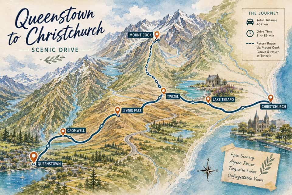
This drive feels like a different landscape altogether from the alpine passes and rainforest further west on the South Island. The Mackenzie Country is all big sky and open space — golden tussock hills, glacial lakes in colours that don’t look quite real, and some of the clearest night skies anywhere on Earth. It’s a landscape shaped by scale rather than detail, and it rewards slowing down as much as any mountain crossing does, even if the reasons are different. This is also where many travellers choose to detour north to Aoraki/Mt Cook, New Zealand’s highest peak, before continuing on to Christchurch.
Queenstown to Cromwell
Leaving Queenstown, the road follows the Kawarau River, retracing part of the route many travellers will already know from the Wanaka side of the region — though from here, it continues on rather than turning off toward Wanaka itself.
Cromwell, sitting at the edge of Lake Dunstan, is the first real stop. If you haven’t already spent time here, Old Cromwell Town is worth a wander — a small restored historic precinct of galleries, cafés, and boutique shops built during the gold-mining era. The roadside stonefruit stalls are hard to pass up in season, and if you’re looking to stretch your legs properly, Cromwell is also a genuine cycling hub, with the Lake Dunstan Trail offering an easy, well-formed ride along the lake edge, and the wider Central Otago Rail Trail beginning nearby for more experienced riders.
From Cromwell, the road turns north through Tarras, leaving the lakes behind and climbing steadily toward the Lindis Pass.
Cromwell to Lindis Pass
From Cromwell, the road turns north through Tarras, leaving the lakes behind and climbing steadily toward the Lindis Pass. If you’re heading directly to Mount Cook Village rather than stopping along the way, it’s roughly 203 km (126 miles) from Cromwell, around 2 hours 34 minutes of driving — though as the stops ahead make clear, this isn’t really a route built for rushing.
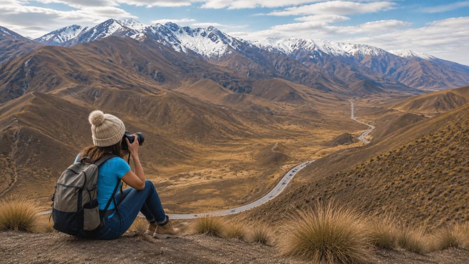
The Lindis Pass is one of only three alpine roads crossing the Southern Alps, reaching 971 metres at its summit — golden, tussock-covered hill country that looks almost otherworldly, especially in the low light of early morning or late afternoon. A short stop at the lookout is worth it just to take in the scale of the landscape.
For those with a bit more time and energy, an unmarked but rewarding walk climbs Double Peak, the mountain rising directly behind the pass — a steep but short 45-60 minute hike gaining around 352 metres to a summit at 1,323 metres, with sweeping views back over the pass and surrounding tussock country. It’s easy to miss, but a genuinely worthwhile detour if you’re not in a rush.
Lindis Pass to Omarama
A little further along, Omarama is a small township worth pausing in, best known for the Omarama Hot Tubs — private, wood-fired hot tubs set up specifically to take in the surrounding mountain views, a genuinely relaxing way to break up the drive.
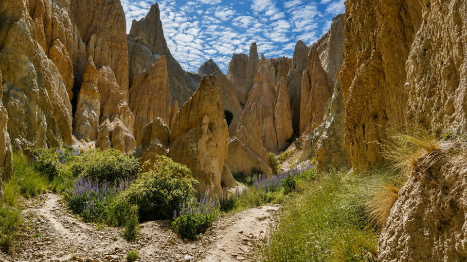
Just out of town, the Clay Cliffs are worth the detour if you have time — striking eroded pinnacles of clay and gravel that look almost like a miniature canyon. The formations began as layers of gravel, silt, and sand, laid down by ancient rivers and lakes over roughly 2 to 20 million years. Movement along the nearby Ostler Fault later pushed these soft sediment layers upward, tilting them at sharp angles, and centuries of rain, wind, and weathering have since carved them into the jagged pinnacles and narrow ravines visible today.
They’re on private land, about 45 km (35 minutes) from Twizel: turn west onto Quailburn Road from SH8 (roughly 4.5 km north of Omarama), follow it for about 3.8 km, then turn left onto Henburn Road and continue a further 3.4 km to the gate, where a $5 NZD honesty-box fee applies.
Omarama to Twizel
Twizel wasn’t originally meant to exist for long. Built in 1968 to house workers on the Upper Waitaki hydroelectric scheme, it was a purpose-built construction town of prefabricated homes, home to as many as 6,000 people at its peak, with a planned demolition once the dams, canals, and tunnels were finished. When the scheme wrapped up in the early 1980s, residents fought hard to keep the town alive rather than see it dismantled — and won, giving Twizel the permanent community and easygoing layout it has today.
That construction era left behind an unlikely legacy: over 50 km of hydro canals feeding water from Lakes Tekapo, Pukaki, and Ōhau to four power stations, now considered by Fish & Game to be the most popular freshwater fishery in the country. The canals’ stable temperature and flow, free from flooding, have produced some genuinely enormous trout and salmon — a 20.1 kg trout caught in the Ōhau canal in 2020 set a world record. If you’ve got a rod, it’s worth casting a line; if not, watching other anglers along the canal banks is a good excuse for a short stop.
Just south of town, High Country Salmon is worth the stop — a family-owned salmon farm and floating café on the Wairepo Arm of Lake Ruataniwha, raising premium chinook (king) salmon in the same clean, constantly flowing hydro canal water. You can dine on sashimi, sushi, or salmon straight from the water at Logans floating café, feed the salmon for free from the deck, buy fresh or smoked salmon to take with you, or even try your hand at catching your own. It’s a genuinely popular stop on this route, so arriving before lunchtime is worth it if you want the full menu before the busier cabinet-food options kick in.
Twizel itself remains a practical, useful stop too — fuel, food, and the turn-off point if you’re heading up SH80 to Aoraki/Mt Cook.
The Road to Aoraki/Mount Cook
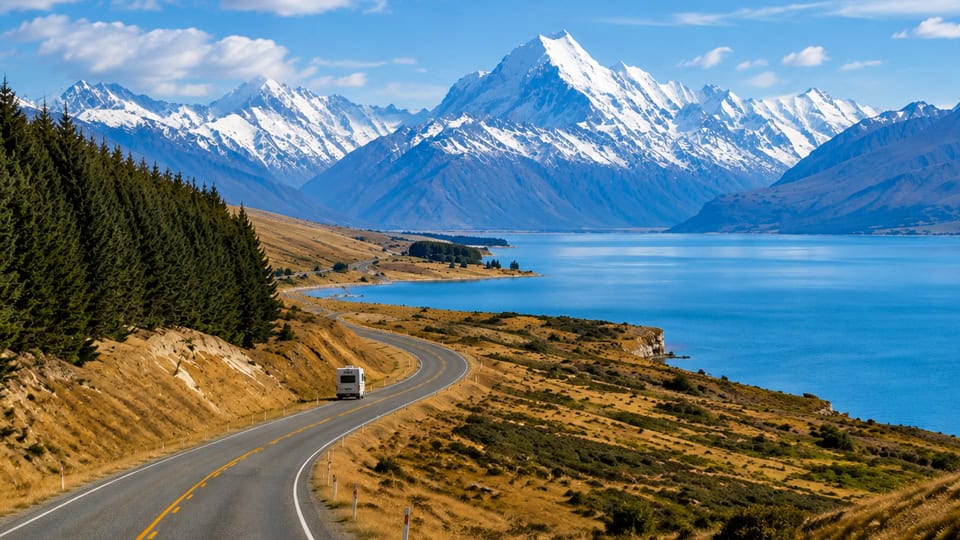
From Twizel, SH80 turns north for the detour up to Aoraki/Mount Cook National Park — home to New Zealand’s highest peak, and worth building an overnight stop around rather than rushing through.
The drive in follows the edge of Lake Pukaki, with the mountain itself often visible ahead for much of the way. Once in the village, there’s enough to fill a full day or two: the Hooker Valley Track, one of the most popular walks in the country, leads through alpine scrubland and across swing bridges to a lake at the foot of the glacier, with Aoraki towering above. Shorter options include the Kea Point and Governors Bush walks, both easy and well-formed if time or energy is limited.
For something different again, the Tasman Glacier Lake is worth the walk out to — a striking glacial lake often dotted with floating icebergs calved from the retreating Tasman Glacier, New Zealand’s longest. Boat tours out among the icebergs are also available for those who want to get closer to the ice itself.
For a different perspective entirely, a scenic flight or heli-hike over the surrounding glaciers and peaks is one of the best ways to appreciate the true scale of the national park — similar to the flights on offer at Franz Josef and Fox Glacier, but over New Zealand’s highest mountain rather than its longest glaciers.
Things To Do in Mount Cook
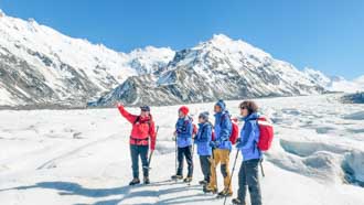
Aoraki/Mount Cook National Park is home to New Zealand’s highest peak and some of its most dramatic alpine scenery — glaciers, turquoise lakes, and walking tracks that lead right into the heart of the Southern Alps. Whether you’re after an easy afternoon walk, a scenic flight over the ice fields, or a boat trip among icebergs on Tasman Lake, here’s what’s worth your time.
Back Down past Lake Pukaki & On to Lake Tekapo
Leaving Mount Cook Village, the road follows Lake Pukaki back down toward SH8, and it’s worth taking slowly rather than rushing straight through. Peter’s Lookout, on Mount Cook Road just before it rejoins the highway, is regarded as one of the best photo spots in the country — sweeping views over the lake’s vivid turquoise water with Aoraki/Mt Cook rising behind it, especially striking in the early morning light. If you’re travelling between late November and December, keep an eye out for wild lupins blooming along the lakeshore — the purple, pink, and blue flowers against the turquoise water and snow-capped peaks is a genuinely spectacular combination, and one of the most photographed scenes in New Zealand.
From Lake Pukaki, it’s a short, easy drive of around 45 km (30-40 minutes) to Lake Tekapo — another striking turquoise lake, and the next stop on this route.
Lake Tekapo
The small township on the lake’s southern shore is one of the best-known stops in the Mackenzie Country. Right on the lakefront sits the Church of the Good Shepherd, a small stone church built in 1935 to honour the region’s early pioneers — probably New Zealand’s most photographed single building, with the mountains framed perfectly through its altar window. It’s a genuinely quiet, reverent spot outside of peak times; arriving before 8am or after 5pm avoids the queue that forms for photos in summer. Beside it, a bronze collie statue stands as a memorial to the working sheep dogs of the Mackenzie high country.
After dark, Tekapo is one of the best places on Earth to see the night sky. It sits at the heart of the Aoraki Mackenzie International Dark Sky Reserve, one of the largest dark sky reserves in the world and the only one that includes inhabited towns — locals have gone as far as installing special non-glare, amber streetlights to help keep the skies this dark. On a clear, moonless night, the Milky Way is visible to the naked eye without any equipment at all, right from the lakefront. For a deeper look, guided tours run up to the Mt John Observatory, home to the University of Canterbury’s research telescopes, with sessions exploring galaxies, nebulae, and star clusters that go well beyond what you’ll see unaided.
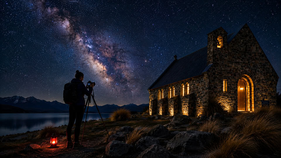
Good idea: if stargazing is a priority, allow at least two nights in Tekapo — cloud cover can force a tour to be rescheduled, and having a spare night in hand makes a big difference.
Things To Do In Lake Tekapo
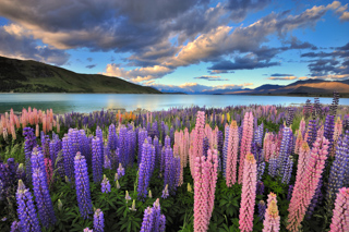
Lake Tekapo is famous for two very different things — by day, its impossibly turquoise water and the lakeside Church of the Good Shepherd; by night, some of the clearest, darkest skies anywhere on Earth. Sitting at the heart of the Aoraki Mackenzie International Dark Sky Reserve, it’s a place worth building a proper stop around, whether you’re here for the views, the stargazing, or both.
The Final Stretch: Tekapo to Christchurch
From Tekapo, the road east crosses Burke’s Pass almost immediately — less a mountain crossing and more a quirky, old-time roadside stop, with a cluster of retro buildings, vintage cars, and Kiwiana memorabilia that feels like stepping into another decade entirely.
A little further on, Fairlie is worth a proper stop, not just a drive-through. Known as the “Gateway to the Mackenzie,” it’s home to the legendary Fairlie Bakehouse — genuinely some of the best pies in the South Island, with flavours ranging from pork belly and apple to smoked chicken and mushroom. History buffs might also detour to the Fairlie Heritage Museum, or further out, the Raincliff Historic Reserve, with its walking trails and ancient Māori rock art.
From here, the road runs through the wide, flat Canterbury Plains toward Christchurch. If you’d rather add a little more scenery than the direct route offers, a detour via Rakaia Gorge is worth considering — a striking braided river crossing, with a roadside viewpoint for a quick photo stop, or the longer Rakaia Gorge Walkway (10 km return) if you’ve got a few hours to spare. This route also passes near Mt Hutt, one of Canterbury’s most popular ski fields in winter, and through Methven, a small township with cafés and pubs worth knowing about if you need a proper sit-down meal.
Arriving Back in Christchurch
However you’ve made your way here, the drive ends back where this journey began — Christchurch, the South Island’s largest city. After the wide-open spaces of the Mackenzie Country, it’s a fitting place to finish: a city that’s spent the years since 2011 rebuilding itself with striking modern architecture, revitalised gardens, and a creative energy that continues to surprise first-time visitors. Whether you’re staying on for a few days or heading straight to the airport, it’s worth taking the time to explore the riverside precinct and botanical gardens before your trip comes to a close.
Things To Do in Christchurch
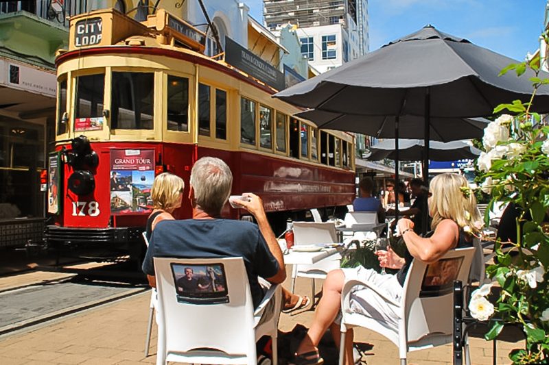
Christchurch has spent the years since 2011 reinventing itself — striking modern architecture, revitalised gardens, and a creative energy that surprises many first-time visitors. Whether you’re just passing through or staying a few days, here’s what’s worth your time in New Zealand’s largest South Island city.
Queenstown to Christchurch Drive FAQs
What are the highlights of the Queenstown to Christchurch drive via Lindis Pass, Lake Pukaki, Lake Tekapo and Mount Cook?
The Queenstown to Christchurch drive is one of New Zealand’s most scenic road trips, taking in the rolling tussock landscapes of Lindis Pass, the turquoise waters of Lake Pukaki, a worthwhile detour to Aoraki/Mount Cook National Park, and the lakeside beauty of Lake Tekapo. The journey finishes with an easy drive across the Canterbury Plains into Christchurch, offering plenty of opportunities to stop for short walks, photography, cafés and alpine viewpoints along the way.
Is the Lindis Pass Double Peak hike worth doing?
Yes. The Double Peak Track is one of the best short hikes in the Lindis Pass area, taking around 45–60 minutes return with approximately 352 metres of elevation gain. Although the route is unmarked in places, the summit rewards walkers with panoramic views across the Lindis Pass, surrounding mountain ranges and iconic Central Otago tussock landscapes.
What can I do in Aoraki/Mount Cook National Park?
Aoraki/Mount Cook National Park is home to New Zealand’s highest mountain and offers activities for every visitor. Popular walks include the Hooker Valley Track, Kea Point Track and Governors Bush Walk, while the Tasman Glacier Lake provides the opportunity to see floating icebergs. Scenic flights, helicopter landings and heli-hikes offer unforgettable aerial views, and staying overnight in Mount Cook Village gives you time to experience both the scenery and the exceptional night skies.
Why is Lake Tekapo famous for stargazing, and what else should I do there?
Lake Tekapo lies within the Aoraki Mackenzie International Dark Sky Reserve, making it one of the world’s premier stargazing destinations. During the day, visit the Church of the Good Shepherd, enjoy the lakefront walking tracks or relax at the Tekapo Springs hot pools. After dark, join a guided stargazing experience or visit Mt John Observatory to view planets, galaxies and star clusters. If possible, spend at least two nights to maximise your chances of clear skies.
Where should I stop between Lake Tekapo and Christchurch?
There are several worthwhile stops on the drive from Lake Tekapo to Christchurch. Burke’s Pass offers a historic alpine village atmosphere, Fairlie is well known for its famous Fairlie Bakehouse pies and welcoming cafés, while Methven is an excellent place for lunch or a break before reaching Christchurch. If time allows, a detour to Rakaia Gorge provides spectacular river views. Travellers heading towards Mount Cook will also find Twizel an ideal place for fuel, groceries, cafés and accommodation before or after exploring Aoraki/Mount Cook National Park.