Christchurch

Home / Tour

Page Created: 22nd July 2026

Arthur's Pass or Lewis Pass — Choose Your Route to the West Coast

The drive from Christchurch to Greymouth is one of New Zealand’s most spectacular road trips, crossing the Southern Alps via either Arthur’s Pass or Lewis Pass before descending to the rugged West Coast.

There are two ways to drive from Christchurch to Greymouth, and they couldn’t feel more different. One climbs over the Southern Alps through Arthur’s Pass, past limestone boulders and alpine kea, on one of New Zealand’s great mountain crossings. The other heads north through Hanmer Springs and over the gentler Lewis Pass, arriving at the coast via the Pancake Rocks and blowholes at Punakaiki. Both roads lead to the same place. How you get there is up to you.

New Zealand driving guide sign: 'Destination to Destination' with a winding mountain road beside a blue lake and alpine scenery.
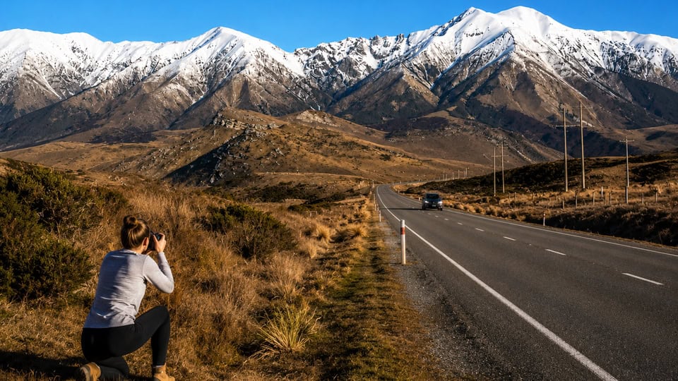
Photographer kneeling in brush taking a photo of snow-capped mountains across a rural highway at golden hour

If you don’t have a car, the Arthur’s Pass route can still be done without driving — the TranzAlpine train follows this route through to Greymouth. Alternatively, it’s common for travellers to drop off a hire car in Christchurch and pick up another on arrival at Greymouth, picking up the rest of the West Coast from there.

Tranz Alpine Train Journey: Christchurch to Greymouth

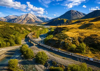
Railway tracks wind through a green valley with a river, mountains, and a bright blue sky above.

Travel through the spectacular Southern Alps aboard the world-famous TranzAlpine from Christchurch to Greymouth. Relax as you pass native beech forests, snow-capped peaks, the braided Waimakariri River and Arthur’s Pass National Park, with panoramic windows, an open-air viewing carriage and GPS-triggered audio commentary available at every seat.   Cost: $239 per person  Chid $167.30

Two Routes, One Destination — What Each Journey Offers

Route A — Arthur's Pass (SH73)

Distance: ~240 km · Drive time: around 3 hours 20 minutes

  • Crosses the Southern Alps at 920 metres — one of New Zealand’s great alpine highway crossings
  • Castle Hill’s giant limestone boulders, a short and easy stop right beside the road
  • Close encounters with kea, New Zealand’s cheeky alpine parrot, on short walks near the pass
  • Native beech forest, waterfalls, and dramatic valley views the whole way through
  • Option to ride the TranzAlpine train instead of driving, then rejoin the road at Greymouth
  • Worth staying overnight at Arthur’s Pass if you have the time, with a good range of accommodation and both short and longer alpine walks to choose from
  • The shorter and more direct of the two routes, though also the one most likely to close in winter snow

Route B — Lewis Pass via Hanmer Springs (SH7)

Distance: ~345 km · Drive time: around 4 hours 30 minutes (longer if you take the coastal option via Westport)

  • Stop at Hanmer Springs to soak in the thermal pools before continuing over the alps
  • Crosses Lewis Pass at 907 metres, a gentler and often more weather-reliable alternative to Arthur’s Pass
  • Passes through Reefton, one of the West Coast’s old gold-mining towns, where you can choose to head direct to Greymouth or via Westport
  • The Westport option adds a scenic coastal drive with extra stops along the way, including the Pancake Rocks and Blowholes at Punakaiki (best timed around high tide) — and Karamea beyond, if you have time
  • A longer drive overall, but one with more stops and more variety along the way
  • Often the preferred route if Arthur’s Pass is closed by snow

Which Route Should You Take?

Choose Arthur’s Pass if: you want the shorter drive, love mountain scenery, and want a real chance of spotting kea in the wild.

Choose Lewis Pass if: you’ve got an extra hour to spare, want to soak in Hanmer Springs on the way, and don’t want to miss Punakaiki’s Pancake Rocks.

Either way: both roads can close temporarily in winter snow — Lewis Pass tends to stay open more reliably, so it’s worth having as your backup if Arthur’s Pass is closed the day you travel.

Bright blue sky with two large fluffy white cumulus clouds.

Route A — Christchurch to Greymouth via Arthur's Pass

Leaving Christchurch, the Canterbury Plains stretch out flat and wide for the first hour, giving little hint of what’s ahead. Then the land starts to lift. Farmland gives way to foothills, and within about ninety minutes you’ll reach Castle Hill — a rolling paddock scattered with limestone boulders the size of houses, easy to pull over and wander through for twenty minutes or so.

From there the road climbs properly. Beech forest closes in, waterfalls appear against the rock faces, and the temperature drops as you near Arthur’s Pass village, tucked right at the base of the summit. This is prime kea territory — New Zealand’s only alpine parrot, intelligent and completely unbothered by people, often turns up right around the village and the short walking tracks nearby.

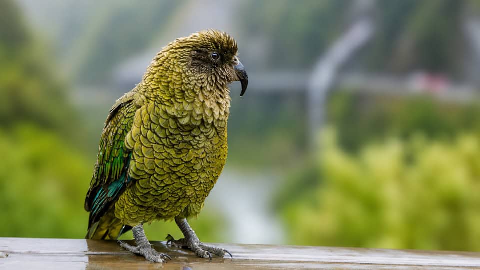
Green parrot with yellow-green feathers perched on a wet wooden railing, with a blurred green landscape in the background
Kea at Arthurs Pass

Over the top, the descent to the coast is quick. Beech forest turns to dense rainforest, the Otira Viaduct carries the road across a steep gorge, and within about an hour of the summit you’re rolling into Greymouth.

Getting there without driving yourself: several operators run day trips from Christchurch to Arthur’s Pass, and Flying Kiwi runs scheduled transport from Christchurch through to Greymouth and on down the West Coast — a good option if you’d rather sit back and watch the scenery than drive it.

Route ‘A’ addition:
Worth staying overnight? Arthur’s Pass rewards travellers who aren’t in a rush. Staying overnight lets you experience New Zealand’s dramatic Southern Alps at a relaxed pace rather than rushing through on a day trip from Christchurch or the West Coast — with time for the area’s longer alpine hikes, better odds of spotting kea and other native wildlife, and a proper feel for the remote mountain atmosphere after the day-trippers have moved on. The village has a good range of accommodation to suit.

Route B — Christchurch to Greymouth via Lewis Pass & Hanmer Springs

Distance: ~345 km · Drive time: around 4 hours 30 minutes (longer if you take the coastal option via Westport)

This route heads north out of Christchurch first, through the Waipara wine district, before reaching Hanmer Springs after about an hour and forty minutes. It’s worth treating this as a proper stop rather than a drive-through — the thermal pools are the obvious drawcard, but the town itself makes a good stretch-your-legs break before the alpine crossing ahead. For more on what to do here, see our [Hanmer Springs page].

From Hanmer, the road climbs gradually into Lewis Pass, reaching 907 metres at its summit — lower than Arthur’s Pass, and generally more reliable in bad weather. There are several short walks through beech forest if you want to get out of the car, and Maruia Springs offers another hot pool stop right beside the road if one soak wasn’t enough.

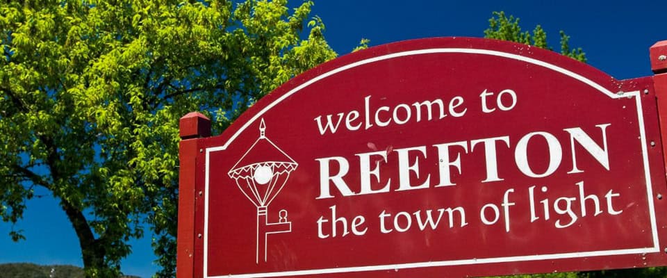
Beyond the pass, the road runs through Reefton, once known as “the town of light” for being the first in New Zealand to have public electricity — a handful of original 1880s buildings still line the main street if you want a short wander.

Red welcome sign for Reefton reading 'welcome to REEFTON the town of light' against a blue sky with green trees nearby (informational)

Route ‘B’ addition:
Worth staying overnight? Reefton makes a good stopping point in its own right. An overnight stay lets you take in this charming 19th-century gold-mining town at a relaxed pace, surrounded by the rugged Victoria Forest Park — with time for heritage walks, local craft gin tasting, and a go at gold panning, before continuing to the coast the next day.

At Reefton, you’ll choose your final stretch to the coast:

  • South to Greymouth — the shorter, direct inland road.
  • North to Westport, then south down the coast — longer, but a genuinely scenic drive in its own right, with plenty of worthwhile stops along the way.
  • The Westport to Greymouth coastal option

    Turning north to Westport opens up one of the West Coast’s best scenic stretches, with several stops worth building time in for:

    • Tauranga Bay Seal Colony — a short walk to a lookout over a resident fur seal colony, just south of Cape Foulwind.
    • Cape Foulwind — a walkway along dramatic coastal cliffs, with a lighthouse and sweeping Tasman Sea views.

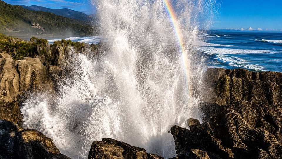
    Heading south from Westport, the road brings you to the Pancake Rocks and Blowholes at Punakaiki, about 46 km (40 minutes) north of Greymouth. They’re worth timing around high tide, when the sea surges through the rock formations and can shoot spray metres into the air — at low tide, it’s a much quieter sight, so it’s worth checking a [tide table] before you arrive. Punakaiki itself has accommodation and a local pub/restaurant, and makes a better overnight base than Greymouth if your timing allows — it puts you right on the doorstep for an early or late tide, rather than adding a 40-minute drive back out the next day.  TIDE TIMES

Ocean waves crash against jagged rocks with a burst of spray forming a rainbow overhead and blue sky beyond the coastgrouped scene
Pancake Rocks at High Tide Punakaiki

If you’re continuing north instead of turning back to Greymouth, Westport is also the turn-off for Karamea, at the very end of the state highway. It’s a there-and-back detour rather than a through-route, but the drawcard is the Ōpārara Basin — giant limestone arches and caves hidden in rainforest, genuinely off the tourist trail and one of the West Coast’s best-kept secrets. We cover this drive in full on our  new-zealand-best-kept-secrets/

Arriving on the Coast — Greymouth and Beyond

However you’ve made your way here, both routes bring you into Greymouth, the largest town on the West Coast and a good base to stop, refuel, and get your bearings before continuing south.

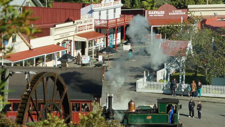
A short stop worth making is Shantytown Heritage Park, a recreated 1880s gold-mining town just south of Greymouth, complete with a steam train, gold panning, and a genuine sense of what life was like here during the rush. It’s an easy, well-signposted stop if you’ve got an hour or two to spare.

Down at the river mouth, it’s worth a short wander to watch the fishing boats coming and going across the Grey River bar — on a rough day, this is genuinely one of the more nerve-wracking pieces of local seamanship in the country, with skippers timing their crossing carefully against the swell. It’s a small thing, but it says a lot about the character of this coast.

Where to spend the night: rather than staying in Greymouth itself, it’s worth pushing on another 40 minutes south to Hokitika. There’s more to fill an evening and a morning here — scenic walks, drives, and driftwood beaches — and after dark, it’s home to the Glow Worm Dell, a short and free roadside walk on State Highway 6 where glow worms light up the bush. Timing matters: aim to arrive at least an hour to ninety minutes after sunset, once it’s properly dark, for the best display.

Where next: for the full range of things to do in Hokitika and along the coast, see our West Coast page. things-to-do-west-coast-of-the-south-island/

Green steam locomotive on a historic western town street with wooden storefronts, a water wheel, and bystanders.
Shantytowm - Greymouth

Frequently Asked Questions About Driving from Christchurch to Greymouth


Page 1 of 2